Locals say that you can’t truly call yourself a Peachlander until you have summited Pincushion Mountain. One of the best known and most loved hikes, Pincushion Mountain is named after a wildfire in the 19th century that destroyed most of the trees on the mountain, leaving only burned trees that looked like pins. Today, Pincushion Mountain is very scenic, and it is a challenging, but rewarding hike. The top of Pincushion Mountain offers one of the best views in the Okanagan Valley. The trail begins with stairs and then becomes switchbacks. It has several steep sections, so proper footwear and even walking sticks are recommended. There are three look-out points that will allow you to rest before you hike to the summit. At the top, you’ll want to take an iconic selfie of the Canadian Flag and of the view. Then, sign the guestbook! The total hike has an elevation of 245 m.
The trail in spring can be hard to see if there is patchy snow still on the ground. If the area is still cold/icy, the trail will be slippery and in spring the mud will be slippery. In summer when the trail is dry the gravel is slippery. Be careful. The trail is well trod and there are trail markers— either bits of pink ribbon or old red signs high up on trees. Stay on trail as much as possible and be observant. It’s a totally worthwhile trek!
Directions
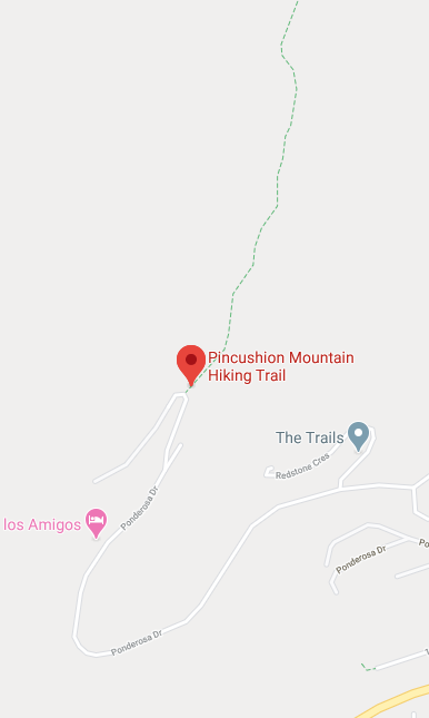
Travel on highway 97 south to Peachland. Take Ponderosa Drive and follow it to the end (there are a few possible turn offs— make sure you follow it to the end). Park in the Pincushion Mountain parking lot.
Learn more about this hike at www.hikingaddiction.ca
Photos courtesy of @grue_056 and HikingAddiction.ca


